weather

Photo: As cold weather breaks, Dave's Ice Cream opens for the season

By Howard B. Owens

It's gotta be some sort of sign that spring is near when Dave's starts selling ice cream.

Owner Debra Webster would have opened a week ago, but she couldn't even get the ice off the parking lot. Finally, the parking lot is clear and the doors are open.

Webster has been in the ice cream business for 28 years, starting at the location that is now Dave's when she was 16. Six months later, she was the manager (it was Brenden's then) and working full time even while attending high school.

In 1995, she bought her first ice cream shop, an Abbott's Frozen Custard franchise in Brockport, which she still owns. Eight years ago, she bought Brenden's and changed the name to Dave's.

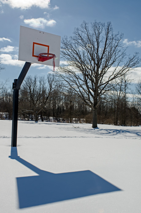
Photo: No hoops in Kibbe Park today

By Howard B. Owens

It's been another chilly day in Genesee County, but at least the sun's been out.

There is a wind-chill advisory in place for tonight starting at 6 p.m. Single-digit temperatures combined with winds of 10 to 15 mph should produce a wind chill of minus 15.

Photo: Kibbe Park, Batavia.

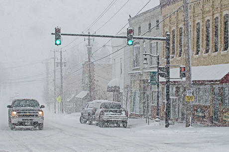
Photo: Snowfall in Oakfield

By Howard B. Owens

At about 10 a.m., the snow was coming down pretty heavy in the Village of Oakfield.

Winter weather advisory issued for snow and wind, cold and low visibility

By Howard B. Owens

A short, but heavy snow storm is expected this morning, with visibility reduced to a quarter mile or less.

As much as an inch to an inch-and-a-half of snow fall per hour is possible. A total of three inches of snow is possible.

Strong winds will create blowing snow, contributing to the low visibility.

Colder temperatures, in the single digits, will follow the snowstorm, and combined with winds, will create a dangerously low wind-chill factor. The temperature could be as low as 20 degrees below zero.

Hazardous weather outlook, high wind warning issued by weather service

By Billie Owens

In addition to the flood watch for Genesee County issued by the National Weather Service, a high wind warning has been issued along with a hazardous weather outlook.

The flood watch is for 6 p.m. through Friday afternoon.

The high wind warning is in effect from 2 a.m. through 10 p.m. Friday.

The hazardous weather outlook starts tonight, potentially lasting until Wednesday.

As a cold front crosses the area Friday morning, there is the potential for the development of a squall like that could producd damaging winds and heavy rain. Strong winds of 25 to 35 mph, with gusts up to 60 mph, are predicted. Additional strong winds with gusts from 45 to 50 mph are possible for Saturday.

"Winds of this magnitude will bring down some trees and power lines. Travel will be difficult in high profile vehicles, especially along the Thruway."

Flood watch issued for Thursday evening and Friday

By Howard B. Owens

A flood watch has been issued for Thursday night and Friday with the expectation of temperatures into the 50s and rain.

Melting snow and rain create the potential for significant run-off, while ice on local creeks could dam constricted waterways, creating an even greater potential for flooding.

During the rainy weather, thunderstorms are possible.

Photo: Snow ripples off Richley Road

By Howard B. Owens

I started to call these snowdrifts, but they look more like the ripples left in sand as the tide retreats at a beach.

We are more than half way through winter.

The photo was taken off Richley Road, Darien, this morning.

Heavier snow expected this afternoon

By Howard B. Owens

In case you haven't noticed, it's snowing.

So far, light snowfall, but the weather service says it will become heavier this afternoon and travel will become more difficult.

A winter storm warning remains in effect through tonight.

The governor has declared a state of emergency for the whole state, but on the conference call this morning, he mainly talked about the weather impacts Downstate.

Be careful out there.

Photo: Jackson Street

Photos: The Sun Before the Storm

By Howard B. Owens

With the sun out this morning, I went for a short drive out to the Bethany area thinking, "the sun before the storm."

Our previous winter storm watch has been upgraded to a warning and between tonight and tomorrow night, we could get up to 10 inches of snow.

Heading down Clipnock Road, I spotted a group of trainers working out harness racing horses.

Bottom picture, a broken barn door on Transit Road.

Winter storm watch issued for Tuesday and Wednesday

By Howard B. Owens

A winter storm watch has been issued for Tuesday evening through Wednesday evening.

There's a potential of snow accumulations of more than six inches with visibility of less than a half mile.

Forecasters say there is still uncertainty as to the storm's exact track. A change in the track could alter snowfall totals.

Photos: Blowing snow in Bergen

By Howard B. Owens

The snow was really blowing out in Bergen and Byron this afternoon.

Top photo is from Route 262 looking south down Batavia Byron Road. Bottom photo is a little further east on Route 262.

It's Officially Too Dang Cold

By Howard B. Owens

Alex Roberts was walking with her son Taariq, 3, this morning down Vine Street after dropping her daughter off at school.

Today is our eighth-straight day of lows in single digits, but a warming trend starts tomorrow with a predicted low of 23 degrees. Highs in the low 30s are predicted for Friday and Saturday.

There's also snow in the forecast.

A wind chill advisory remains in effect until 3 p.m.

Two school districts announce closures this morning

By Howard B. Owens

Oakfield-Alabama schools are closed this morning, due to weather.

Pavilion school is closed, due to plumbing issues.

Pavilion students scheduled to take a regents exam at Pavilion High School are to report to the elementary building at their scheduled test time.

The National Weather Service has a wind chill advisory in effect until 10 a.m. with wind chills expected to be 15 to 25 degrees below zero.

Closing for Tuesday due to weather

By Howard B. Owens

The Oakfield-Alabama Central School District has announced schools are cancelled for Tuesday due to anticipated dangerous wind chill. After school and evening activities are also cancelled.

Also cancelled, Batavia City schools, St. Joe's, YMCA preschool.


Wind chill brings school closures

By Howard B. Owens

Batavia City Schools, Alexander, Oakfield-Alabama, Pembroke and St. Joe's have all announced closures this morning due to weather.

A wind chill warning is in effect through tomorrow morning. The expected wind chill is from 25 to 30 below zero.

Winds and snow are also creating hazardous driving conditions.

Photo: Night snowfall in Downtown Batavia

By Howard B. Owens

Batavia was hit with a couple of inches of snow this evening, but the weather has cleared a bit more now. Photo of East Main Street at Jackson taken about 8 p.m. when snow was still falling.

Photo: Flag barn in Corfu in the snow

By Howard B. Owens

If you've ever driven down Route 33 heading into Corfu, you've seen this barn.

When I left Le Roy at 2:30, there was no snow falling. As I arrived in Corfu at 3:15, it was coming down pretty good.

Today's storm prediction downgraded by weather service

By Howard B. Owens

The winter weather warning previously issued for today has been cancelled by National Weather Service.

There is a weather advisory in place through 11 p.m.

A wind chill advisory remains in effect from midnight through noon, Sunday.

Snow accumulations through tonight are expected to be 2 to 4 inches. Winds will be 15 to 25 mph with gusts up to 45 mph.

Wind chills could be 20 below.

Here comes the snow again

By Howard B. Owens

The National Weather Service has issued a winter storm warning with a prediction of 3 to 6 inches of snow falling on Genesee County tonight and tomorrow, winds of 20 to 30 mph and a wind chill of 20 below.

The warning is in effect for 24 hours started at 7 p.m.

The wind chill advisory starts at midnight Saturday and goes to noon Sunday.

Travel conditions tonight could deteriorite quickly.

Snow and wind predicted for tomorrow afternoon

By Howard B. Owens

With 2 to 4 inches of snow expected, and 20 to 30 mph winds, the National Weather Serivce has issued a winter weather advisory or tomorrow at 2 p.m. through 7 p.m., Saturday.

There is also a wind child advisory in place from 10 p.m. tonight through noon tomorrow.

Blowing snow could contribute to hazardous travel conditions.

Authentically Local