Photos: Sunset, Kelsey Road, Batavia

Two photos of the sunset taken off Kelsey Road in the town of Batavia on Tuesday evening.
Photos submitted by Corey Coles.


Two photos of the sunset taken off Kelsey Road in the town of Batavia on Tuesday evening.
Photos submitted by Corey Coles.
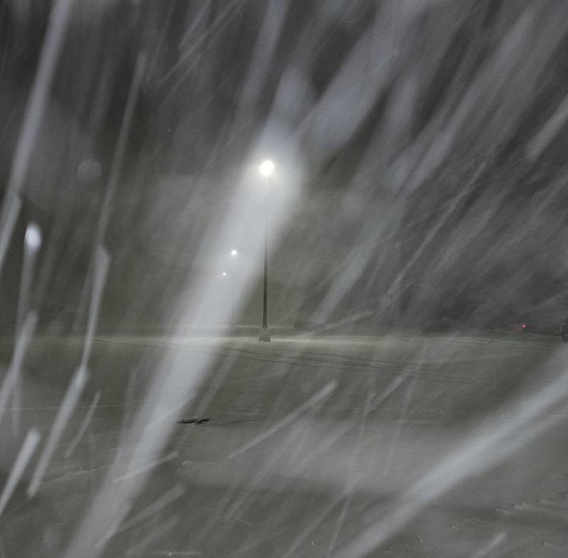
A high wind watch starts on Wednesday at 11 a.m., carrying a significant threat to safety and property, according to the National Weather Service.
Forecasters expect winds of 25 to 35 mph with gusts up to 60 mph.
High winds are expected through Wednesday night.
Possible difficulties include toppled trees, downed power lines, scattered power outages, and travel could be difficult, especially for high-profile vehicles.


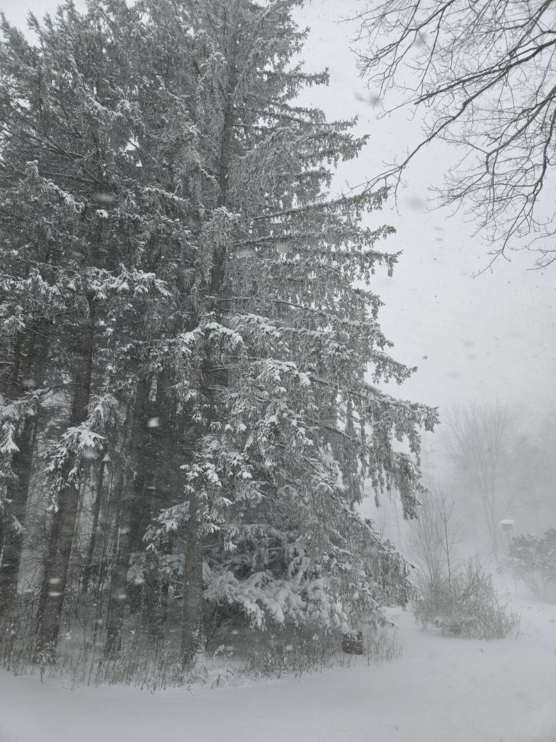
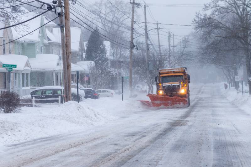
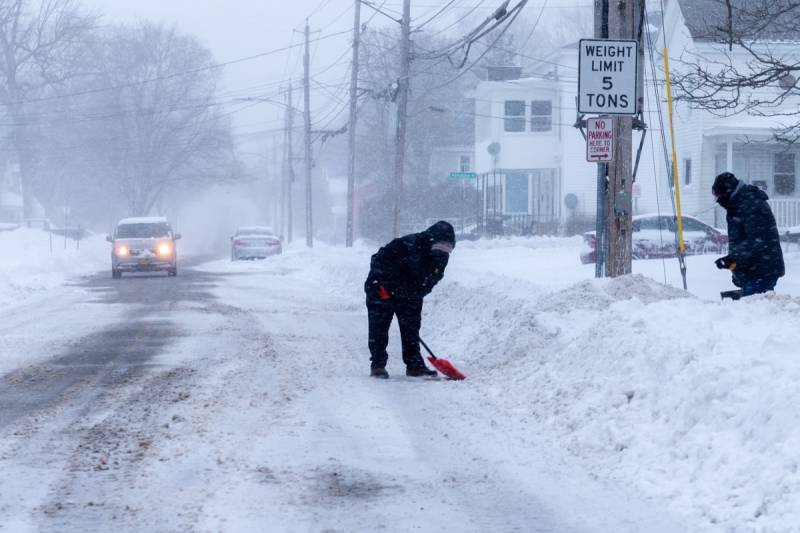
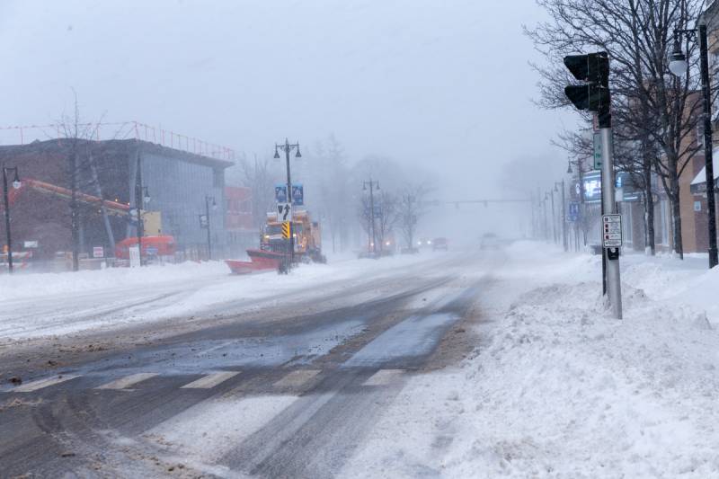
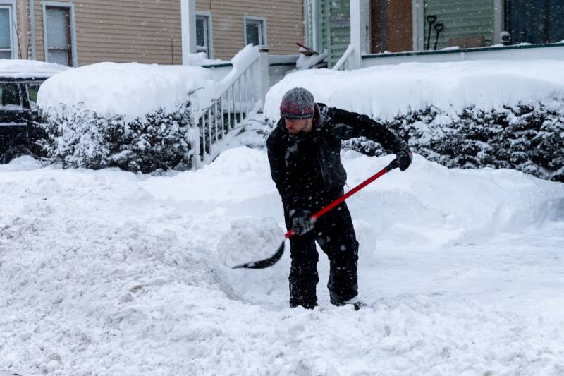
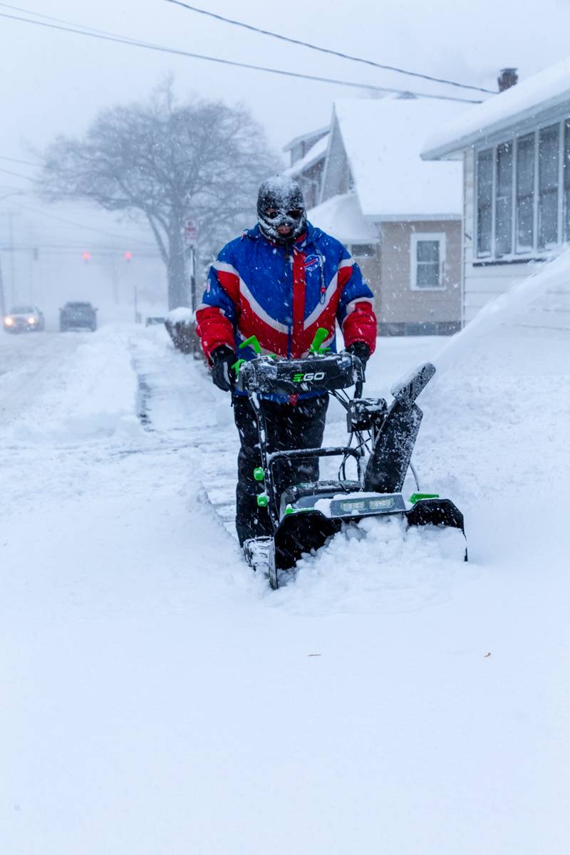
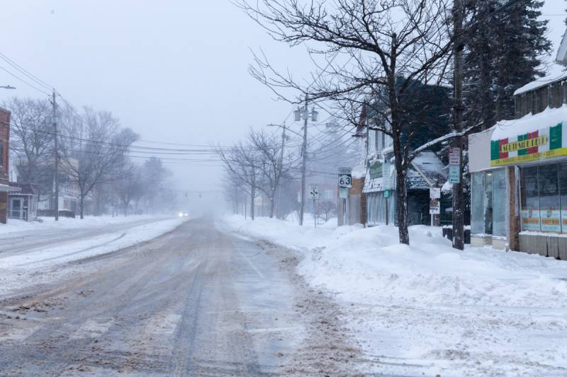
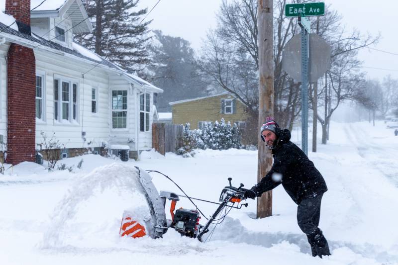
There was plenty of snow around Batavia on Sunday afternoon that needed to be moved, so city crews and local residents dug in and did the hard work of digging out.
More than a foot of snow fell on Batavia in the previous 24 hours.
A travel advisory remains in effect until 7 a.m. on Monday.
Photos by Steve Ognibene
NOTE: Please email weather-related photos to news@thebatavian.com.
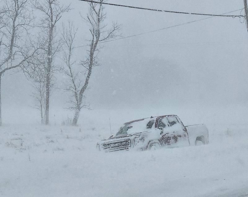
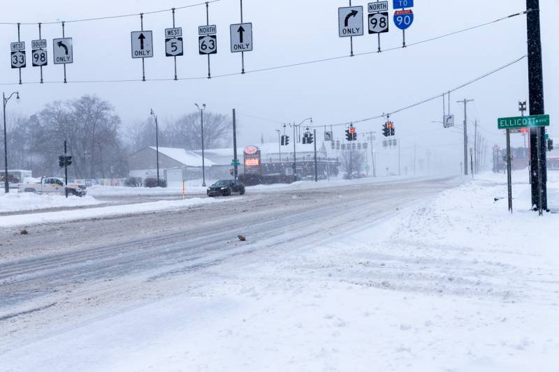
A black Kia is off the road at the Thruway interchange, just before Route 77. One occupant complaining of an arm injury. Pembroke and Indian Falls dispatched.
East Pembroke's chief is out with multiple vehicles off the road, all occupied, at 2855 Main Road.
In Pembroke, a driver was stuck in a ditch, was helped out, and then tried to leave on her own and got stuck again. Dadwells responded, and the driver refused to pay for the tow.
There is an accident in Pavilion on Route 63 near Cook Road. Pavilion Fire is on scene. Bethany Fire has shut down traffic at Texaco Town. No injuries.
UPDATE 11:41 a.m.: A black sedan is stuck in the roadway at Swan Street and Ellicott Street, Batavia.
UPDATE 11:47 a.m.: Bethany Fire requested to Wyoming to fill in. Wyoming is working a structure fire.
UPDATE 12:03 p.m.: A deputy is out with a box truck and another vehicle off the road on Route 77 south of the village of Corfu.
UPDATE 12:28 p.m.: A Chevy silver Trac is off the road on Route 77.
UPDATE 12:42 p.m.: A tanker is off the road on Broadway Road. A vehicle is off the road on Clinton Street Road.
UPDATE 12:45 p.m.: A tractor-trailer is stuck on Route 33 near Reed Road, Pembroke.
UPDATE 12:48 p.m.: A vehicle is off the road at Railroad and Broadway, Alexander. A Spectrum truck is off the road, muddled location.
UPDATE 1:03 p.m.: A deputy is asked to return to 9575 Alleghany Road to assist with traffic control at the request of a tow truck operator. The deputy reports he just found another vehicle off the road and would check status before responding.
UPDATE 1:06 p.m.: Traffic is blocked in both directions at some location on Route 77,
UPDATE 1:11 p.m.: A deputy reports they were able to get one lane open.
UPDATE 1:54 p.m.: Corfu fire police requested to shutdown southbound traffic at Route 33 for Route 77. A Rav 4 is stuck in the road at Alleghany and Broadway, Darien.
UPDATE 2:29 p.m.: A deputy is out with a vehicle at Route 33 and Ellinwood Road, Corfu.
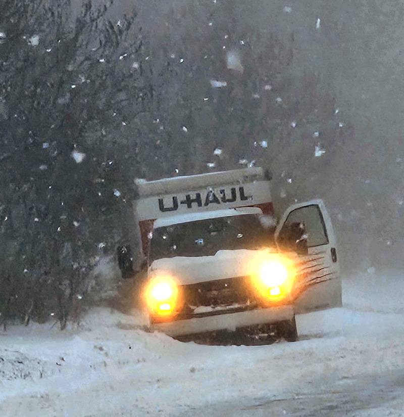
UPDATE 3 p.m.: A U-Haul is off the road on Route 33.
UPDATE 3:04 p.m.: A snowmobile rollover accident is reported on Slusser Road. The patient is inside a residence with a leg injury. East Pembroke Fire and Mercy EMS dispatched.
UPDATE 3:19 p.m.: An SUV vs. snowplow accident is reported at Ellicott Street Road and Bethany Le Roy Road. The SUV is on its side. Bethany Fire and Stafford Fire along with Mercy EMS dispatched.
UPDATE 4:02 p.m.: From the Bethany accident, three ambulances - Bethany and two Mercy EMS units -- transporting patients to Strong.
UPDATE 4:32 p.m.: Route 20 at Route 63 is closed eastbound because of vehicles in the road.
UPDATE 5:10 p.m.: There are tractor-trailers blocking Route 77 near Flying J. A deputy requested to help get them moved into the Flying J parking lot or the school parking lot.
Press release:
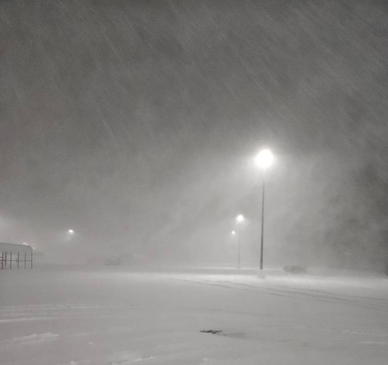
The Genesee County Sheriff’s Office, in conjunction with the Genesee County Highway Department, Emergency Management Services, and the County Manager, is continuing the travel advisory for all of Genesee County. The advisory is anticipated to remain throughout the day on Sunday due to heavy snowfall, strong winds, and zero visibility, resulting in unsafe travel conditions. An update will be provided once the weather conditions improve.
Sheriff Sheron and all emergency services first responders would like to thank residents for their cooperation in adhering to the travel advisory by staying off the roads and asking for continued cooperation today.
“Please remember, even if it is not snowing where you are, the destination you are traveling to may have poor visibility and heavy snow accumulation. The best and safest option for you and your loved ones is to stay home until the snowstorm passes,” stated Sheriff Sheron.
During a travel advisory roads are not closed, however, no unnecessary travel is advised. A trip that could wait should not be made until the advisory is lifted. The Genesee County Sheriff's Office does not determine the necessity for any individual to report to work.
Here are the announcements submitted due to weather. Email your announcements to news@thebatavian.com.
6:41 p.m.: A deputy looking for a vehicle off the road at 33 and Angling couldn't locate it, reporting whiteout conditions. The Corfu fire chief was also in the area and a short time later, he located the vehicle off the road. He reports no injuries. Another deputy on another call at another location (didn't catch the location) reports poor visibility.
UPDATE 6:48 p.m.: A vehicle is off the road and in a ditch off Bethany Center Road. Occupants are out of the vehicle. A school bus with 22 students on board is off the road and in a ditch at 9998 Day Road, Alexander. No injuries.
UPDATE 7:01 p.m.: A driver of the bus spoke to a supervisor who is en route. The bus isn't that far off the road. The supervisor will determine whether to send out another bus or call a wrecker to get it unstuck.
UPDATE 7:12 p.m.: There are multiple deputies assisting multiple motorists. We didn't hear all of the initial dispatches. One deputy is giving a courtesy lift to a truck driver to the Econo Lodge. On Day Road, the students are being transported by law enforcement vehicles to the fire station.
UPDATE 7:39 p.m.: A car vs. pole accident is reported on Cary in Oakfield. A Blue Jeep Compass, no injuries, is off the road on Oak Orchard Road near Batavia Elba Townline Road, Elba.
UPDATE 8:39 p.m.: The storm band seems to have moved to the south, the wind has died down, scanner traffic has slowed down.
UPDATE 8:50 p.m.: There is a tree down on wires partially blocking the roadway on Hickox Road, Alexander.
UPDATE 9:11 p.m.: An estimated 76 National Grid Customers are without power near Darien Center. Power has been out since 8:39 p.m. National Grid expects to restore power by 10:45 p.m. That is the only significant power outage in Genesee County.
Press release:
In anticipation of the severe weather conditions that are predicted to begin this evening, the Genesee County Sheriff’s Office, in conjunction with the Genesee County Highway Department, Emergency Management Services, and the County Manager, is issuing a travel advisory for all of Genesee County effective this evening until further notice.
Sheriff Sheron encourages residents, “For your safety and the safety of first responders and highway snow removal personnel this weekend, please stay off the roads until conditions improve.”
Motorists are encouraged to avoid all unnecessary travel due to the expected strong winds, heavy snow and sub-zero visibility. These conditions will undoubtedly create treacherous travel for all motorists.
During a travel advisory roads are not closed, however, no unnecessary travel is advised. A trip that could wait should not be made until the advisory is lifted. The Genesee County Sheriff's Office does not determine the necessity for any individual to report to work.
Press release:
On Saturday, Jan. 13, a travel ban for Erie County and the I-90 has been issued due to the severe winter weather forecasted to impact Western New York through Sunday.
The driving ban begins on Saturday, Jan. 13 at 9 p.m. Anyone on the road that is not considered emergency personnel will be ticketed in Erie County and the I-90. The ban will be active till Sunday, Jan. 14 at 6 a.m. Depending on the storm on Sunday, the ban may be extended. A travel advisory for the entire area of Western New York remains in effect.
Additionally, there is a ban on Trucks/tractor trailer traffic on the I-90 from Exit 46 in the Rochester/Henrietta to the Pennsylvania border.
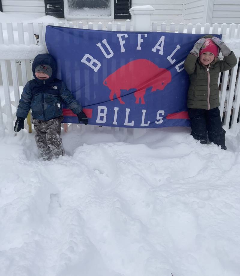
The Buffalo Bills game has been rescheduled to Monday, Jan. 15 at 4:30 p.m.
Troopers will be out checking all major routes of travel to ensure that motorists are as safe as possible and working with local Emergency Operations Centers as needed. The State Police need your assistance to make this possible. Motorists traveling in areas impacted by the snow and ice are asked to leave with extra time to make a slow and careful drive to your destination. Consider the snow accumulation on the roads, the current snowfall rate, the wind, and visibility. Use your best judgment to determine if driving is prudent.
Keep the following tips in mind:
• Get the latest weather forecast before leaving with your local weather apps, monitor radio or TV stations.
• Always clean your windows and mirrors FULLY of any snow and ice before driving.
• Keep a full tank of gas
• Fluid levels are sufficient ( windshield washer fluid, ant-freeze)
• Spare tire is sufficient and you have the jack and wheel wrench
• Use headlights at all times to increase your visibility to others. Remember, if your windshield wipers are in use due to weather, then your headlights must be on.
• Drive prudently. If the conditions are adverse, you should decrease your speed accordingly.
• Brake early
• Do NOT use cruise control. This decreases your reaction time to apply braking.
• Look out for events farther down the road. Creating more time to react can make a difference.
• Be aware of maintenance vehicles and emergency vehicles. Give them room to work.
• If you do not absolutely have to go out on the roads, then don’t.If you do go out, is your vehicle prepared?
Is your trunk supplied to help you to be safe in case you are stopped or stranded in an area without assistance readily available:
- Gloves, blankets, warmers, tool kit, first-aid kit, non-perishable foods, water, working flashlight and batteries, cell phone charger, etc
- Shovel, ice scraper, de-icer, snow brush, rock salt or cat litter, tow chain or cable, jumper cables or battery charger, etc.
If you are involved in a collision or leave the roadway:
- If you drive off the roadway and are stuck in a snow bank or ditch, stay in your vehicle and call 911. DO NOT exit your vehicle unless it is an absolute emergency. You put yourself at risk of being struck by another vehicle.
- Roll your windows down a few inches or turn your vehicle off if you are stranded in snow for a period of time with your vehicle running. Covered mufflers can cause serious physical injury or death due to inhalation of carbon monoxide.
- If you should become stranded on the Thruway or any Roadway, know your location by being aware of your direction and mile post marker. This will help emergency personnel reach your location as quickly as possible.
The Thruway Authority provides a wide variety of information for travelers, including current traffic conditions, accidents, and lane closures. Visit www.thruway.ny.gov for more information.
Slow down. Be prepared. Be safe.

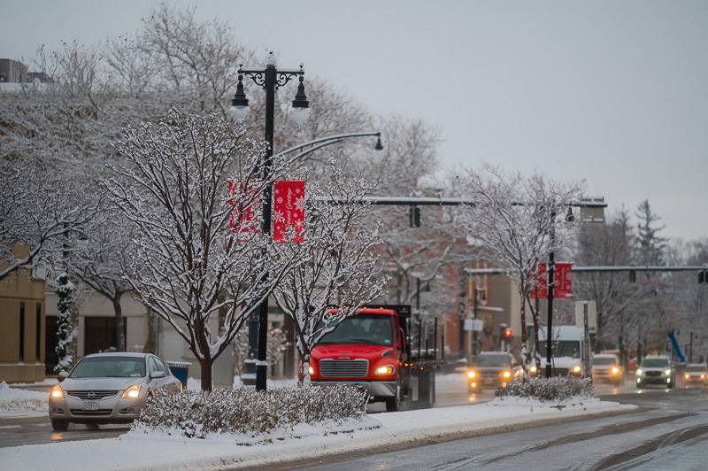
There is a winter storm watch in effect for this weekend.
Up to seven inches of lake-effect snow is possible this weekend, according to the National Weather Service.
A winter storm watch is in effect from Saturday afternoon through Monday morning.
Wind gusts could reach 65 mph.
The weather service states, "Travel could be very difficult to impossible during the weekend. Widespread blowing snow could significantly reduce visibility. The strongest winds will occur Saturday, which could cause tree damage and power outages."


Copyright © 2008-2022 The Batavian. All Rights Reserved. Privacy Policy | Terms of Service
![]()