
Forecast for Genesee County by Mark McLean, weatherman for 13WHAM, official news partner of The Batavian:
Southern portions of Genesee County and northern portions of Wyoming County will likely see snowfall rates between 2 to 4 inches through the remainder of today. This will produce several more feet of snow in areas that have already had several feet of snow. The snow band (as of this writing) has lifted back to near Batavia, but will continue to oscillate over the same areas through the morning commute Wednesday.
A weak storm system will move into WNY on Wednesday and disrupt the lake snow by midday. This general light snow with this next storm system (less than 2 inches) will provide a clean-up break before the next round of very heavy lake snow Wednesday night and Thursday. The Lake Erie snow band on Thursday will produce similar snow rates and intensities with near zero visibility at times, snow rates over 2 inches an hour and treacherous to impossible driving conditions in portions of Genesee, Wyoming, and possibly western Monroe/Livingston counties.
All told, this will likely be a top 10 lake snow event for Lake Erie with many areas seeing more than 4 feet of snow by the end of the week.
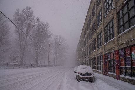
UPDATE 3 p.m.: Added a couple of photos taken a little while ago on Harvester Avenue showing the heavy snow and low visibility conditions currently in the city.
Mother Nature is going to
Mother Nature is going to gives us one day on Wednesday to clean up before She hits us again with the second punch on Thursday!